

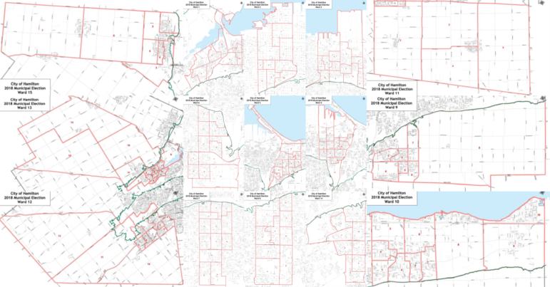
The Public Record obtained the 2018 City of Hamilton Ward Polling Division maps on May 15, 2018 in PDF format. We formally requested the maps in GIS format to the City’s open data office on May 16, and will link to the City’s open data page when they become available there.
Important Note: The polling divisions do not mean the voting location will be within those boundaries; the City will release voting locations on September 4, 2018.
Lower City: Ward 1 | Ward 2 | Ward 3 | Ward 4 | Ward 5
Hamilton Mountain: Ward 6 | Ward 7 | Ward 8 | Ward 14
Eastern Suburbs: Ward 9 | Ward 10 | Ward 11
Western Suburbs: Ward 12 | Ward 13 | Ward 15
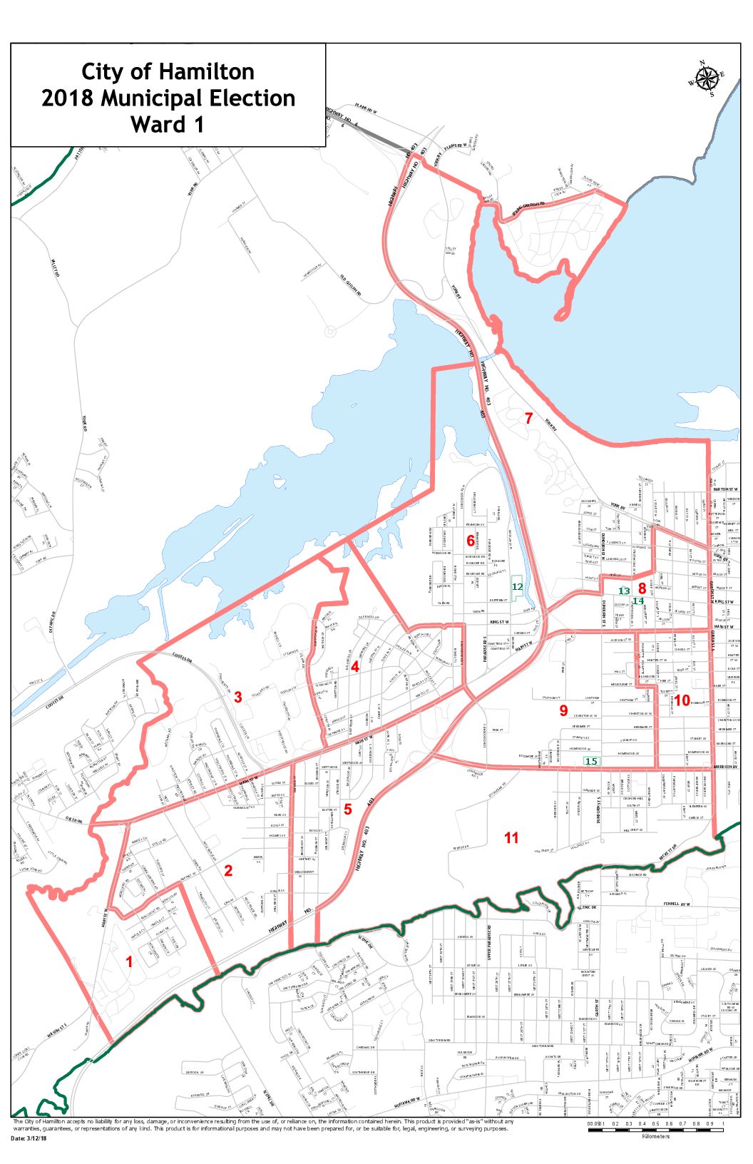
Ward 1
![]()
Download map (right click “Save Link As”): PNG image format | PDF document format
Ward 2
![]()
Download map (right click “Save Link As”): PNG image format | PDF document format
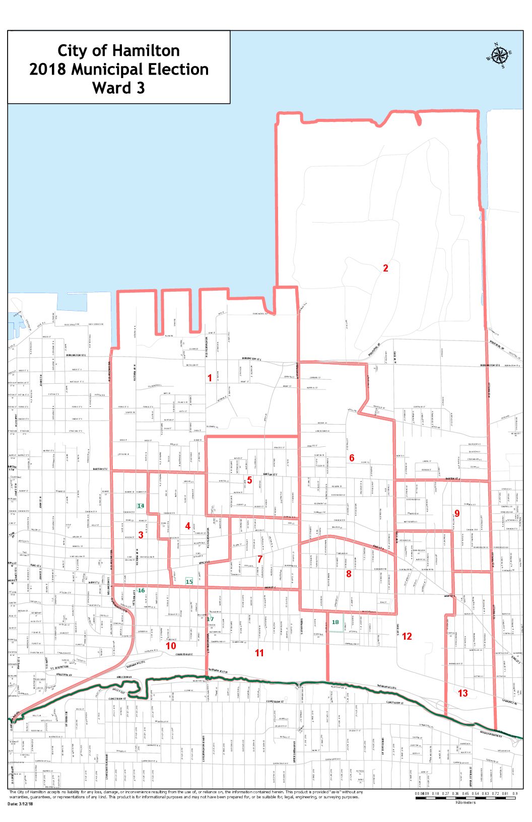
Ward 3
![]()
Download map (right click “Save Link As”): PNG image format | PDF document format
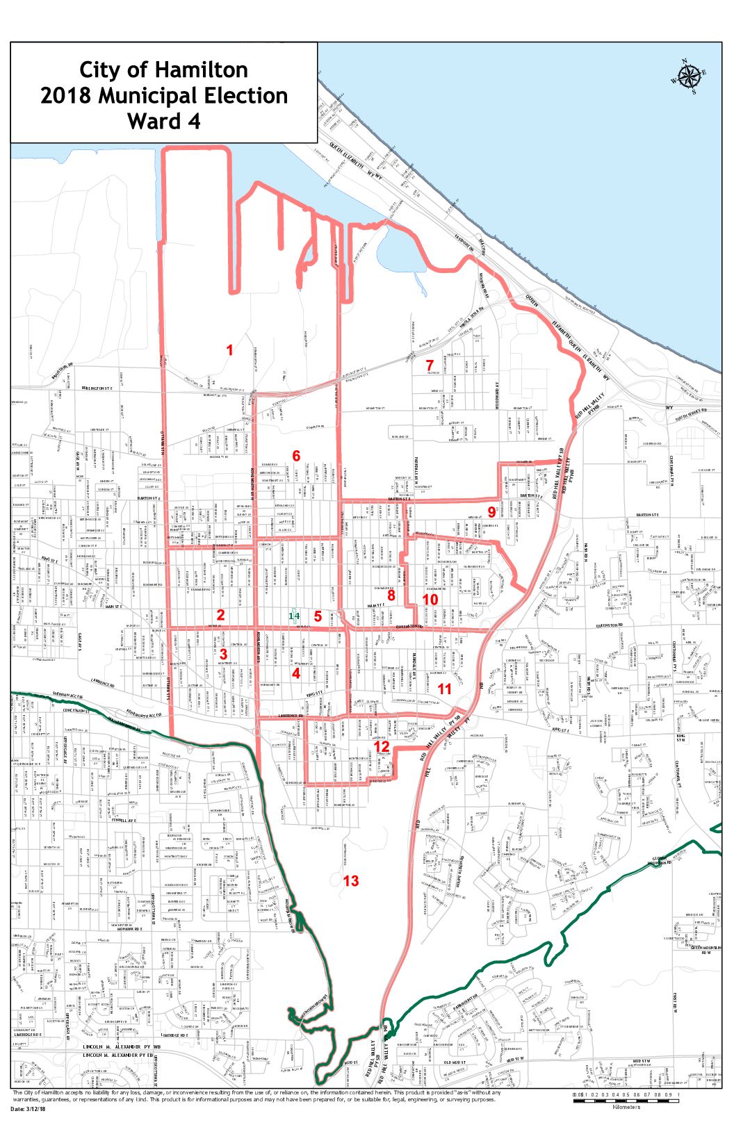
Ward 4
![]()
Download map (right click “Save Link As”): PNG image format | PDF document format
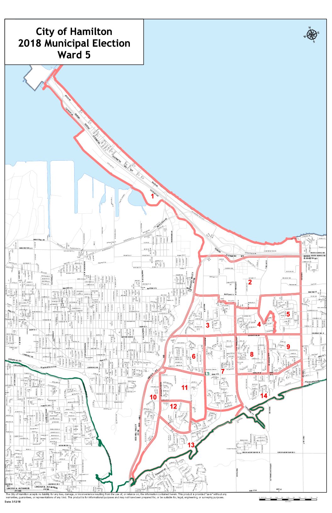
Ward 5
![]()
Download map (right click “Save Link As”): PNG image format | PDF document format
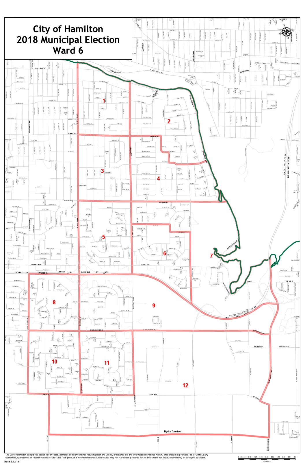
Ward 6
![]()
Download map (right click “Save Link As”): PNG image format | PDF document format
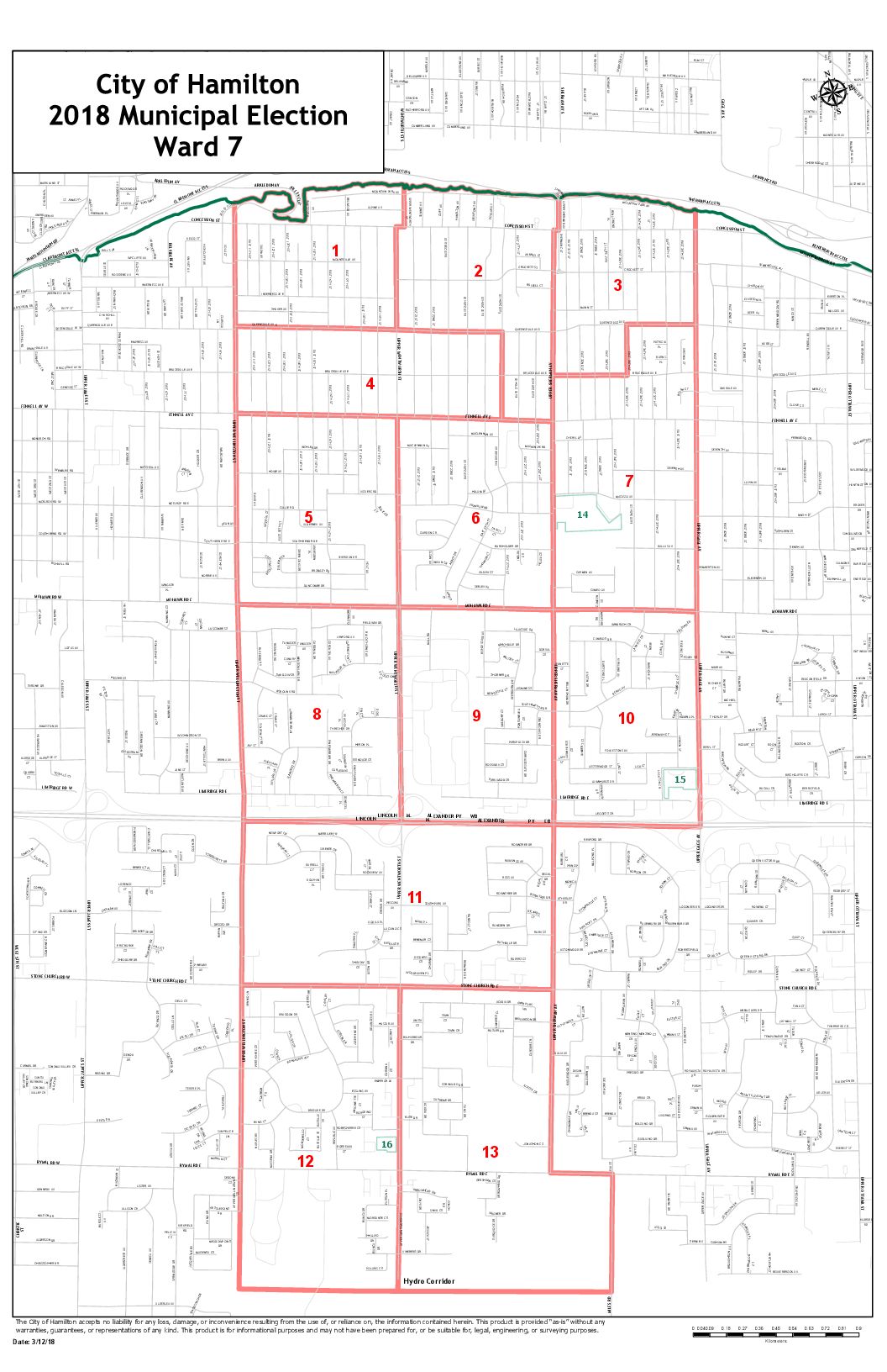
Ward 7
![]()
Download map (right click “Save Link As”): PNG image format | PDF document format
Ward 8
![]()
Download map (right click “Save Link As”): PNG image format | PDF document format
Ward 14
![]()
Download map (right click “Save Link As”): PNG image format | PDF document format
Ward 9
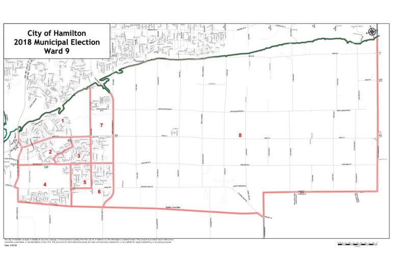
Download map (right click “Save Link As”): PNG image format | PDF document format
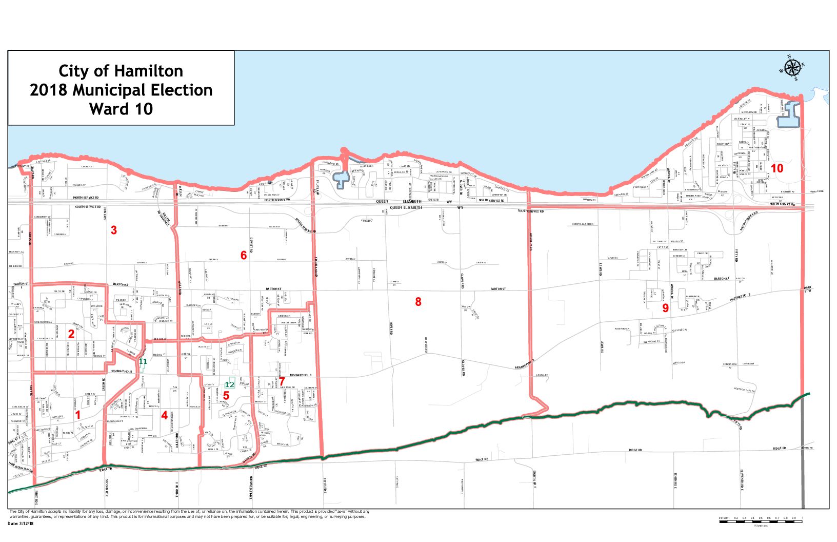
Ward 10

Download map (right click “Save Link As”): PNG image format | PDF document format
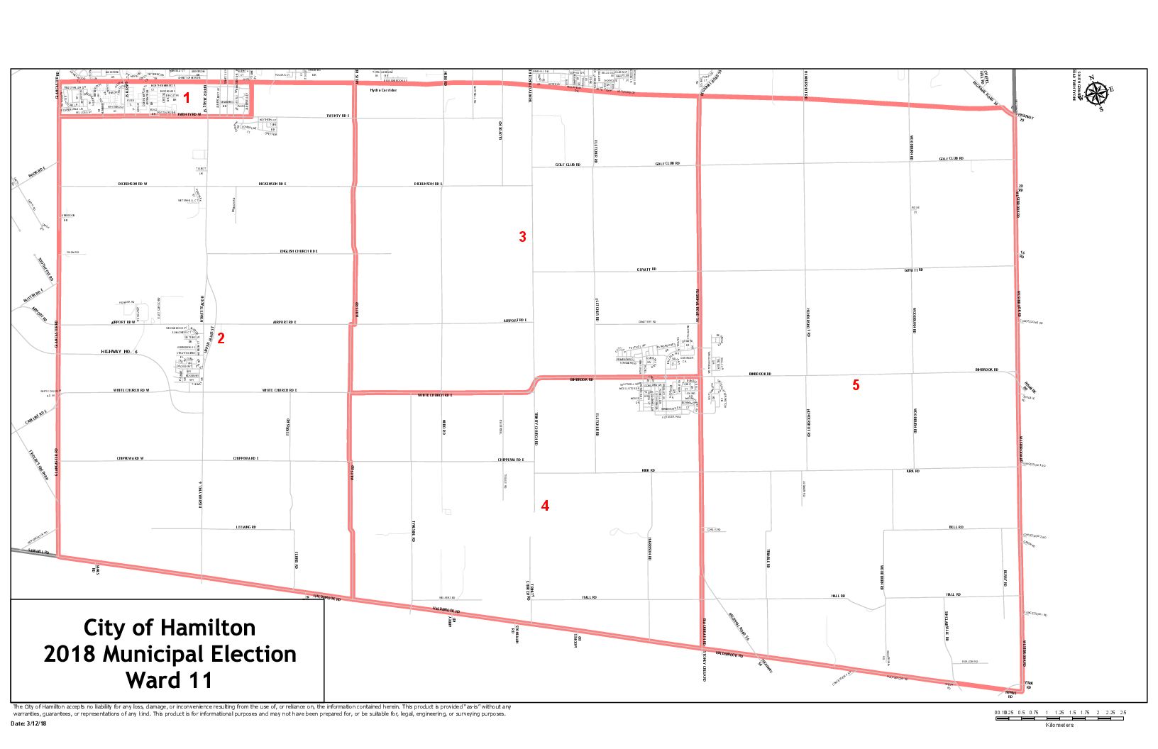
Ward 11

Download map (right click “Save Link As”): PNG image format | PDF document format
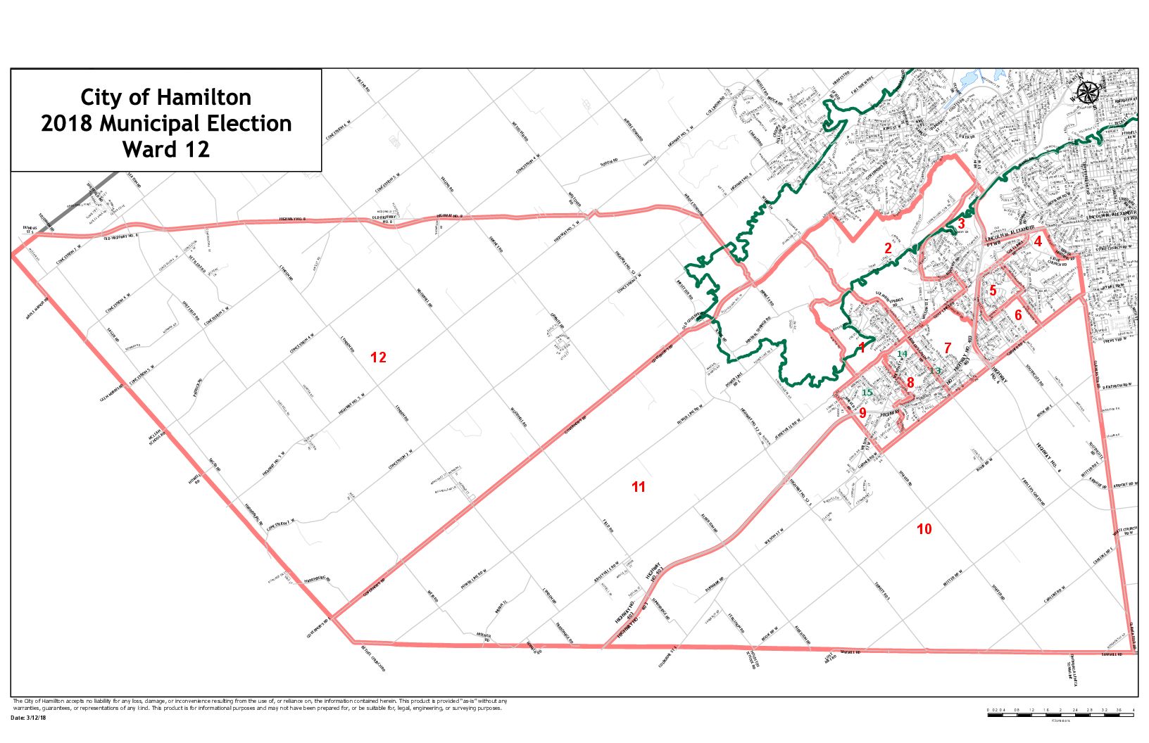
Ward 12
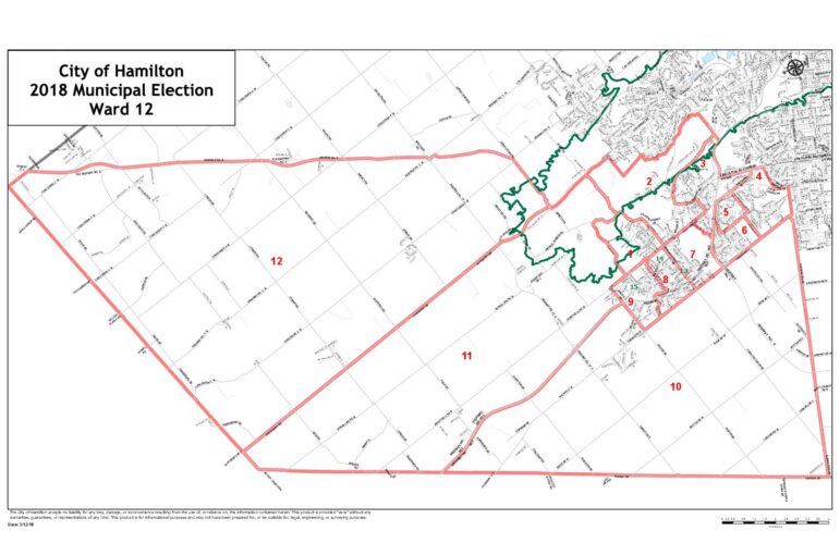
Download map (right click “Save Link As”): PNG image format | PDF document format
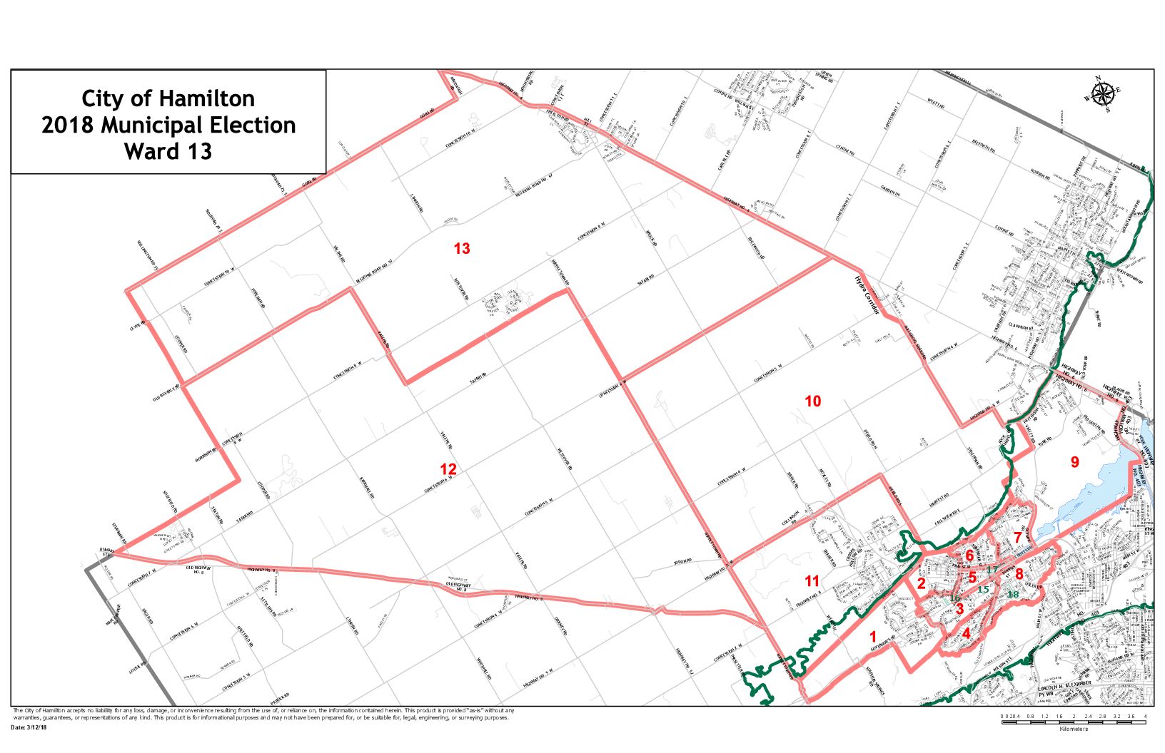
Ward 13
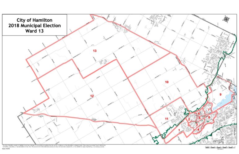
Download map (right click “Save Link As”): PNG image format | PDF document format
Ward 15
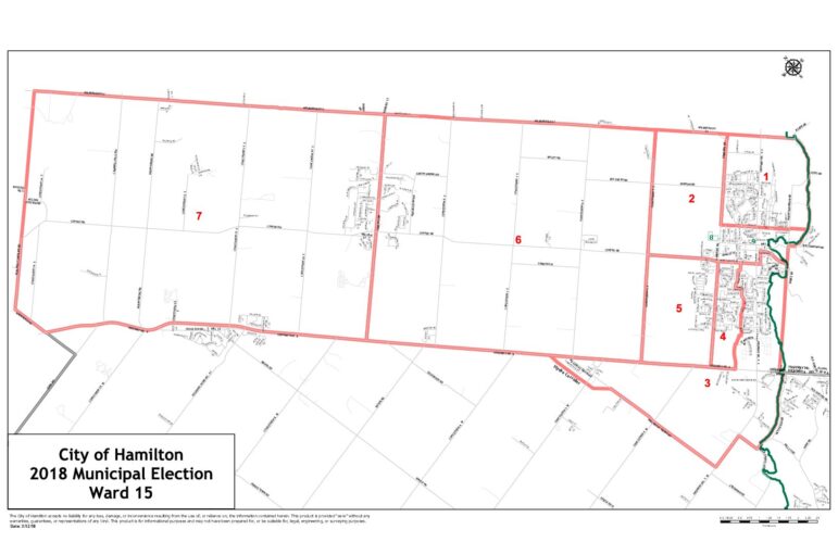
Download map (right click “Save Link As”): PNG image format | PDF document format